UAVs known as unmanned aerial vehicles, and it emerging market of services built around flying robots that can fly by the manually controlled through the remote control or autonomously using software-controlled flight plans in their embedded systems. Majorly Drone services are to assist industries with tasks such as agriculture, construction, search and rescue, package delivery, industrial inspection, insurance and videography, image and measurement collection, and event management or broadcasting.
Surveying with a drone offers many possibilities for GIS professionals. With a drone, it is possible to perform topographic surveys of the same quality as highly accurate measurements collected by traditional methods, but in a fraction of the time. This significantly reduces the cost of a site survey and the workload of field experts.
Geographic Information Systems
ARK Services Pvt. Ltd. being a GIS mapping company collects, organizes and analyzes data be it spatial or non-spatial. With our GIS mapping services, you can gain new insights into data about any location, including resource locations and demographic and consumer trends.
With geographically grouped dynamic data, GIS mapping services are very helpful in learning about a property, location or resource. And as a GIS mapping company, we support many businesses, government agencies, geologists, environmentalists and other groups working towards a better future.
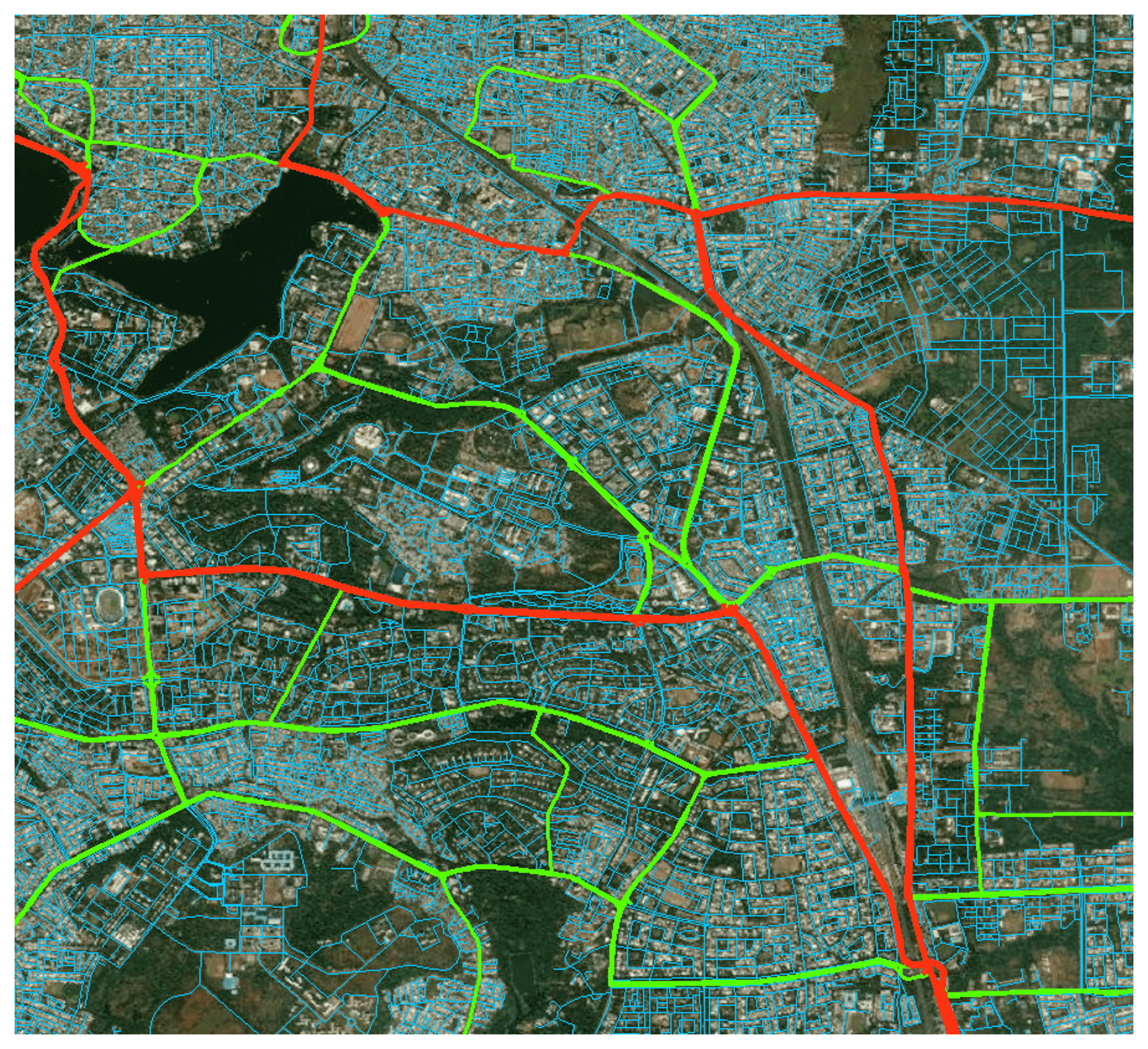
ARK SERVICES PVT. LTD. has the appropriate industry expertise to provide geospatial solutions and services, particularly in the Land Information Systems, Utilities, Telecom, Transportation, Geology and Engineering sectors.
Photogrammetry
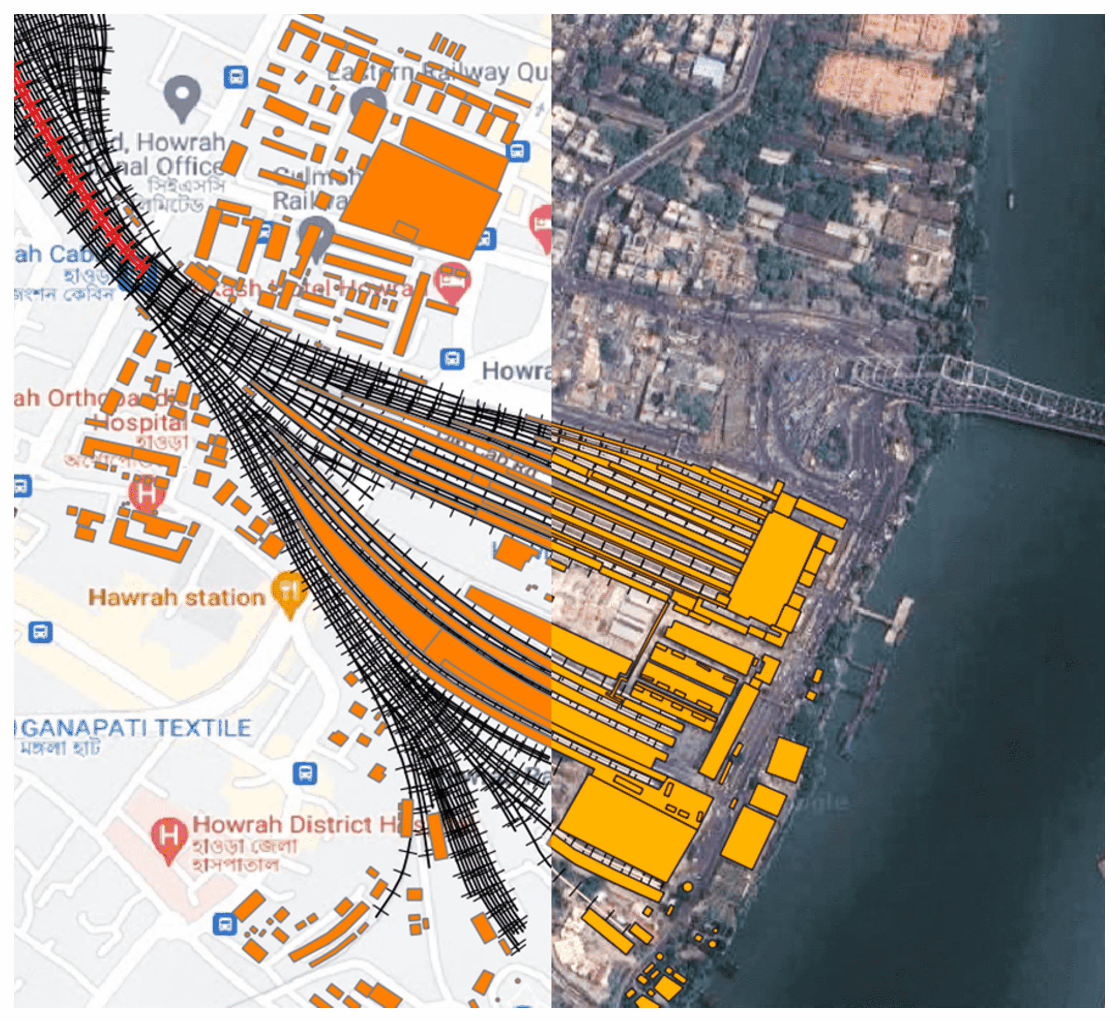
Digital photogrammetry is the science of taking photographs of the earth’s surface and creating digital terrain models (DTM), digital elevation models (DEM), digital surface models (DSM), 3D land models, etc.
Photogrammetry provides visual confirmation of the measured distance between objects and can be applied for a variety of purposes, from urban planning and construction to insurance claims and energy infrastructure.
While aerial imagery helps to accurately measure land features, surface models, and volumetric data, photogrammetric surveys provide an efficient and cost-effective way to develop topographic mapping for your project.
Using the most recent aerial and satellite photography gear, software, and cutting-edge technology, ARK SERVICES PVT. LTD. provides photogrammetric services from aerial photos and stereo satellite images. ARK SERVICES PVT. LTD. offers digital photogrammetric services that meet the needs of the user with the highest level of simplicity and at a price that is globally competitive. The solutions are developed to order and cater to the unique requirements of the clients.
Remote Sensing
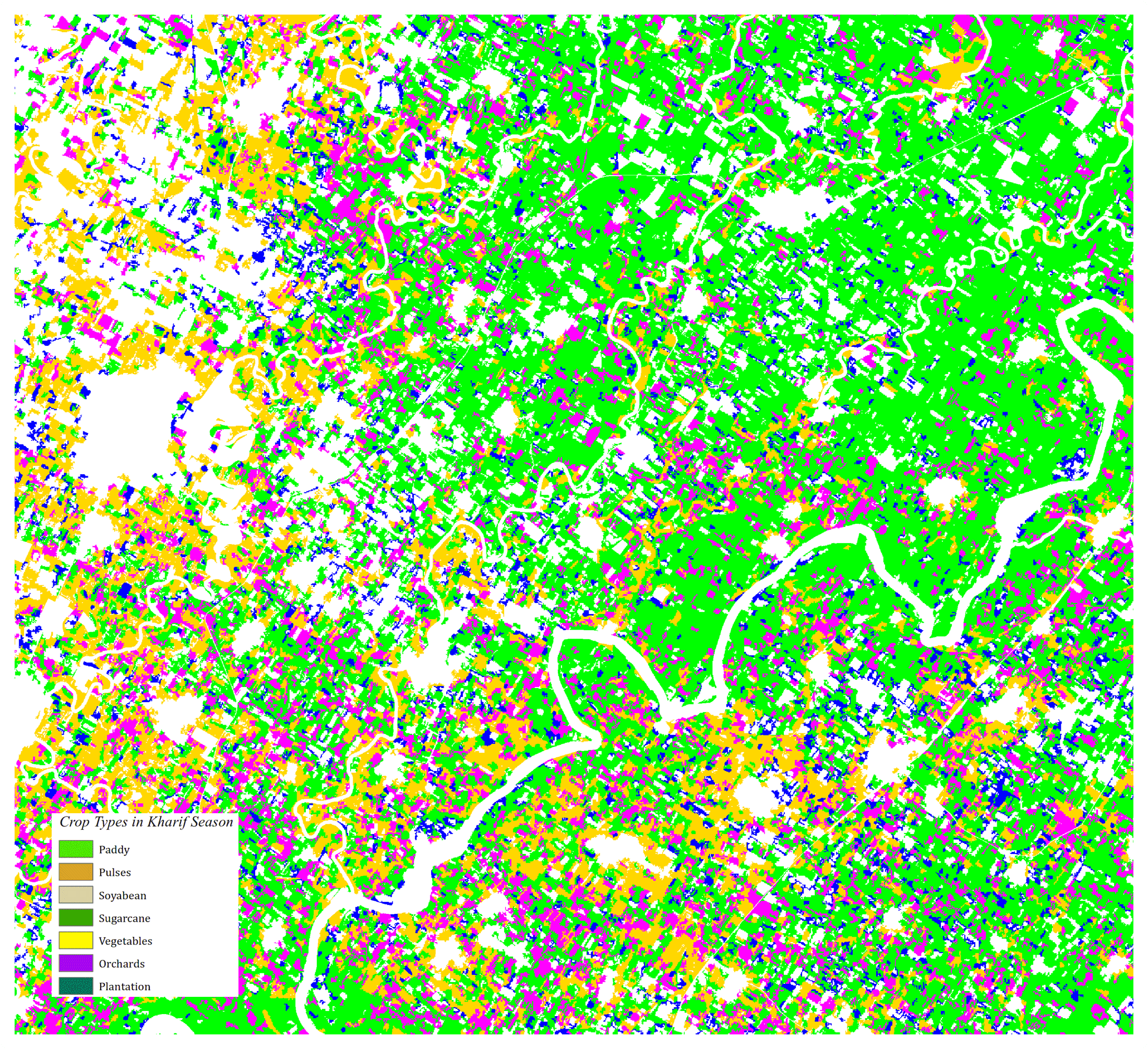
Remote sensing offers a cost-effective method to capture field data for analysis and planning purposes. Layer Informatics offers a number of remote sensing and analysis services including:
Our image interpreters are deployed on a variety of projects, and can quickly meet individual project requirements. We can deploy teams on site for critical tasks and technically challenging data analysis projects.
Remote sensing technology is used in a wide variety of disciplines in thousands of different use cases, including most earth sciences, such as meteorology, geology, hydrology, ecology, oceanography, glaciology, geography, and in land surveying, as well as applications in military, intelligence, commercial, economic and also government use the information for decision making civil defence operations, police.
ARK SERVICES PVT. LTD. has the appropriate industry expertise to provide geospatial solutions and services, particularly in the Land Information Systems, Utilities, Telecom, Transportation, Geology and Engineering sectors.
LIDAR
ARK SERVICES PVT. LTD. is the best LiDAR mapping company providing industrial grade LiDAR data processing services for various industries. LiDAR is the advanced technology in topographic data collection with high speed, high density and accurate data. LiDAR data processing services can be conducted in daylight or even at night also.
ARK SERVICES PVT. LTD. Mapping Services is a well-preferred remote sensing technique for determining the precise location of an object on the Earth’s surface. We as a LiDAR company enable on-field data capture of targets. LiDAR data processing services also include elevation data, so it finds use in various sectors.
ARK SERVICES PVT. LTD. specializes in both drone-based aerial and terrestrial/mobile LiDAR processing types. We get a lot of satisfaction from work.
Our drone LiDAR data processing solutions include topographical maps such as Digital Terrain Model (DTM), Digital Surface Model, Counter Map, Orthomosaic Map, etc.
Photogrammetry provides visual confirmation of the measured distance between objects and can be applied for a variety of purposes, from urban planning and construction to insurance claims and energy infrastructure.
While aerial imagery helps to accurately measure land features, surface models, and volumetric data, photogrammetric surveys provide an efficient and cost-effective way to develop topographic mapping for your project.
Using the most recent aerial and satellite photography gear, software, and cutting-edge technology, ARK SERVICES PVT. LTD. provides photogrammetric services from aerial photos and stereo satellite images. ARK SERVICES PVT. LTD. offers digital photogrammetric services that meet the needs of the user with the highest level of simplicity and at a price that is globally competitive. The solutions are developed to order and cater to the unique requirements of the clients.